A One-Metre Error That Has Locked Residents Out of Insurance and Off Their Own Land for Years
Kimberly Grabham
20 February 2026, 7:00 PM
IN SHORT
State-provided flood mapping contains a reported one-metre error that has incorrectly classified significant portions of Wilcannia and Menindee as flood-prone land. This classification has prevented affected residents from obtaining home and property insurance and has stopped landowners from building on or developing their land. Central Darling Shire has secured grant funding to correct the mapping and develop an updated floodplain management plan based on accurate data.
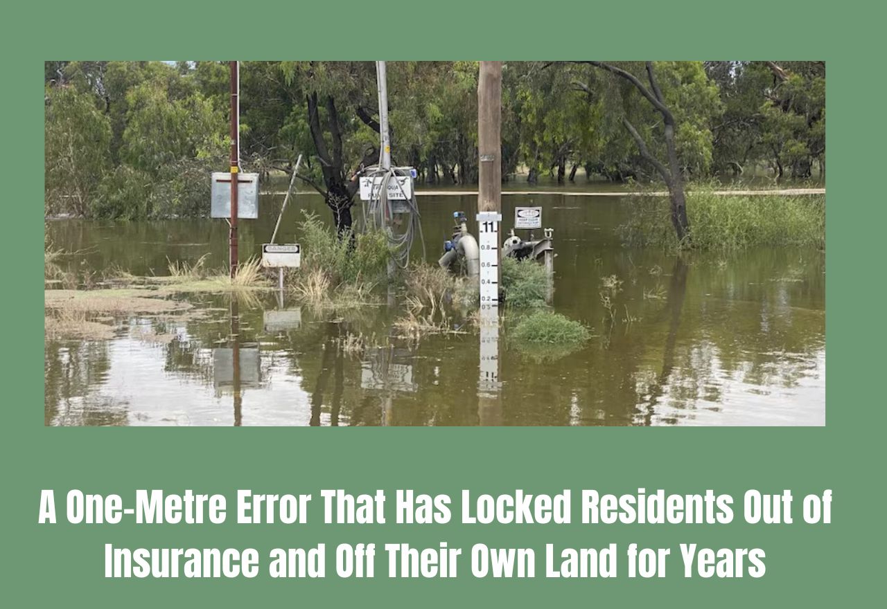
For years, residents of Wilcannia and Menindee say they have been living with the consequences of a government mapping error they had no part in creating. A one-metre inaccuracy in state-provided flood mapping has incorrectly placed large sections of both towns inside flood-prone zones, with consequences that have quietly devastated the ability of ordinary people to insure their homes and develop their land.
Central Darling Shire Council raised the issue at its February ordinary meeting, describing the impact as one of the more significant planning injustices affecting the shire's communities. When land is classified as flood-prone in official state records, a cascade of restrictions follows. Insurers use those records to assess risk, meaning residents in the affected areas face policies they cannot afford or flat-out refusals. State planning directives that apply to flood-affected land prevent new dwellings from being approved and effectively sterilise land from development, even when local knowledge and ground truth say the risk does not exist.
The error, a one-metre discrepancy in the flood modelling used to create the maps, is not a minor administrative footnote. In flat country like the western plains, one metre of elevation difference can move the boundary between a flood-affected zone and dry land by a significant distance. In the towns of Wilcannia and Menindee, where properties sit close to the Darling River system, that error has had real-world consequences for real people over many years.
Council has confirmed it has secured grant funding to correct the mapping and develop a new floodplain management plan for the shire. The new plan will be based on updated survey data and modelling that reflects the actual topography and flood behaviour of the land, rather than the flawed historic records currently sitting in state databases.
The relevance of this issue extends to the broader Darling River corridor. Communities in Balranald, Hay and Carrathool shires also sit in river systems where flood mapping directly shapes planning decisions, insurance markets and land values.
NEWS

SPORT

RURAL


COMMUNITY